In recent years, mobile phones have drawn tremendous interest from the conflict management community. Given the successful, high profile uses of mobile phone-based violence prevention in Kenya in voting during 2010 and 2013, what can the global peacebuilding community learn from Kenya’s application of mobile technology to promote peace in other conflict areas around the world? What are the social and political factors that explain why mobile phones can have a positive effect on conflict prevention efforts in general?

1. A population must prefer non-violence since technology magnifies human intent

Context and intent is critical. One of the most important aspects of using mobile phones for conflict management and peacebuilding is recognizing prevailing local political climate. If a population is inclined toward peace in the midst of a tense situation, then mobile phone-based information sharing can help people promote peace and share information about potential hotspots with neighbors and peacebuilding organizations. Of course if the population has drawn lines and it ready to fight, mobile phones and make it far easier to organize violence. As Kentaro Toyama said, technology amplifies human intent and capacity. When integrating technology into conflict management and peacebuilding, the first step is to have a good idea of the population’s intentions before turning up the volume.

Photo: UN Women

Photo: UN Women

2. The events of violence start and stop relative to specific events

In the case of Kenya, violence erupted during particular period in the political calendar, namely during elections. Thus, violence starts and stops relative to external events, as opposed to being a state of sustained warfare. We have to be realistic about what we intend to do with the technology as it relates to peacebuilding or conflict management. In Kenya, prevention is made easier by the fact that the violence occurs around elections; the peacebuilding community has time to reach out to leaders beforehand, set up programs, test software, and organize networks of trusted reporters. It’s a different kettle of fish when violence is unrelated to something like elections, which are predictable. This starts to get into conflict early warning, where there are methodological and data challenges – we’ll be covering these in TC109, since they present some of the most interesting and difficult issues for conflict prevention.

3. The population knows to use their phones to share information about potential violence

Photo: UNDP

So the population prefers peace, and we all know when violence is going to happen. Now we have to make sure everyone knows that there are people listening when text messages are sent in reporting violence, and where those messages should be sent. Training and public outreach are key to making sure there is participation in a text message-based conflict management or peacebuilding program. This has to go on even when there aren’t high risk events like elections looming. One of the best examples of this kind of training and network building is Sisi Ni Amani, a Kenya-based NGO that does SMS peacebuilding, civic participation and governance training, and conflict mitigation around land disputes. By developing capacity within communities between elections, Sisi Ni Amani helps communities be prepared to respond to, and be proactive in, peacebuilding.

4. Third party actors involved in collecting and validating the crowdsourced data.

Never underestimate the value of having a third party involved in validating and rebroadcasting the information that comes from crowdsourced SMS text messages. In situations where trust between communities may be shaky, having the United Nations or a large NGO monitoring and responding to citizen reports can lend institutional credibility to the information being shared by local citizens.

Endnote: These factors were taken as excerpts from a recently published article titled, “Inter-ethnic Cooperation Revisited: Why mobile phones can help prevent discrete event of violence, using the Kenyan case study.” To read the entire published piece in Stability: International Journal of Security & Development, including works cited, please click here.

Charles Martin-Shields is a doctoral candidate at George Mason University’s School for Conflict Analysis and Resolution. He is currently a Fulbright-Clinton Fellow in Samoa, advising their Ministry of Communications and Information Technology on disaster response and data collection. Learn more from his primary research and also from other technology-for-peacebuilding experts by enrolling today in our upcoming Technology for Conflict Management and Peacebuilding course. The course runs January 13 – February 7, 2014. Group discounts available. Please inquire at info [at] techchange [dot] org.

 

Last Thursday, TechChange was proud to participate in the TechGirls program by inviting two young women from the Middle East to shadow our team during a work day. While we’ve always been committed to tech capacity building in the Middle East, it had been almost two years since we conducted a series of trainings in the West Bank, and we couldn’t pass up a chance to invite future colleagues into our home and share our enthusiasm. According to the State Department, the TechGirls program:

“[P]rovides girls from the Middle East and North Africa with the knowledge and resources to pursue higher education and careers in technology. This program builds on the U.S. global commitment to advance the rights of women and girls around the world.”

Nagham joined us from Nablus, Palestine. She is 16 and started using the computer at the age of 5; and she would like to study IT or Science. Nagham expects to improve her programming and game design skills. Sondos is from Zarqa, Jordan. She is 16 years old and has taken classes in robotics, Visual Basic, Oracle, Invention, Photoshop and HTML and SQL programming. Sondos is especially interested in pursuing technological interests that will aid the field of medicine.

With that in mind, we set up a variety of hands-on workstations that included:

Hands-On Coding and Electronics: Combining Art, Problem-solving, and Circuitry

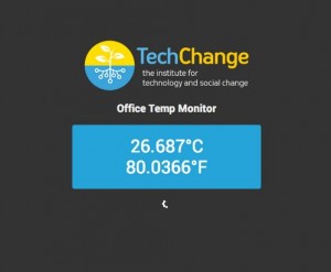
Screenshot of our office temperature as measured by Arduino sensor.

Python-powered office temperature website

Since both TechGirls were interested in both programming and hardware, we started off with our in-house code ninja, Michael Holachek. Michael is 18, an avid robotics enthusiast, and will be attending MIT in the Fall to study Electrical Engineering. Michael started off with a short discussion about the connection between art and electronics (including a TED talk on painting circuits), introduced some basic programming in C and Python, and then demoed a few cool circuits on the Arduino and Raspberry Pi. They then worked together to make a TechChange mood lamp that played the TechChange theme song and display the office temperature on a website. At the end of the session, Sondos and Nagham came up with several ideas for applying these new skills to new problems, including attaching a room thermometer to an Arduino board to trigger an alert if the room became too hot for a baby.

Making Graphic Elements: Generating and Animating TechGirls Avatars

With their new Arduino boards built, both Nagham and Sondos sat down with Pablo Leon and Rachel Roth to try illustrating themselves and then animating their avatars in After Effects. Rachel provided a sketch of our guests and then we loaded them on our custom tablets for illustration. Trying their hands with our stylus, they learned about creating layers, sorting into folders, using filters, etc.

Illustrated avatars of TechGirls

New avatars illustrated by TechGirls!

After they finished creating avatars, Alon Askarov demonstrated how to use the Puppet tool to teach them how create short animations. Given that we were limited by time and that TechChange animations take time (see our blog post on this), these were kept to minimal facial expressions, but we still had fun doing it!

A brief animated loop of Sondos

Animated Sondos

Designing a Four-Week Course: A Tour of mHealth

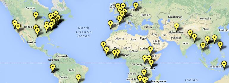
Since Sondos was interested in public health projects, we tried to show off what we’d been working on for our mHealth and maternal health initiatives. We opened up the most recent course that we had built with the UN Foundation on Mobile Phones for Public Health,but rather than the speakers or content, what seemed to be the most interesting was the 161 participants in the course from all around the world. We agree: It is pretty cool.

Student map from our mHealth class

Student map from our mHealth class

But on top of the novelty, we also chatted about how we believed connecting these students was a core part of online learning — not just transferring knowledge on technology, but building a community of practice. After all, technology is the easy part when it comes to mHealth.

Building Interactive Learning Experiences in Articulate

TechGirls Articulate screenshot

But a platform isn’t enough for online learning. Catherine Shen discussed how to structure content for educational purposes. This meant walking through the current courses being designed for State Department, USAID, and the World Bank. Catherine used a current course from OTI Lebanon on advocacy for the TechGirls to see the mechanics of course design at work.

The TechGirls then created a short interactive presentation on their TechChange day, integrating their animated avatar with a survey that the girls used to tell us about their experience. Using a Likert scale, the girls gave their impressions of their shadow day.

The results were clear: Both of our participants strongly agreed that the job shadow day was fun and inspiring, in addition to being informative and interactive.

It was for us as well. Thanks to the TechGirls team for joining us!

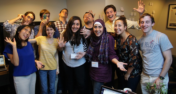
Funny group picture of TechChange and TechGirls

Thanks TechGirls!

This post was written with contributions from the entire TechChange team. Thanks specifically to Catherine Shen and Michael Holachek for contributions in the sections above.

The first step to closing the ever-widening technology gender gap is getting more young girls excited about technology. This is the goal of the State Department-led TechGirls international exchange program, which connects young girls from the Middle East and North Africa with tech mentors in the US. The three-week program aims to connect and support the next generation of women in tech by providing them with a foundation of skills, experience, and networks that can lead to future career opportunities in technology back in their home communities.

It is no secret that our team is passionate about ensuring global inclusion & understanding of tech applications, so you can imagine that we are incredibly excited to be a part of this years’ TechGirls program. On July 11, we will be hosting two budding female technologists, one from Jordan and the other from Palestine. These young women will get a behind-the-scenes look at our DC nerd attic, shadowing different members of the TechChange team.

This will include spending time with our in-house coding ninja Michael, learning the basics of Raspberry Pi and the “Internet of Things.” At another station, they will meet with our learning experience designer Catherine to get an inside perspective on the life cycle of a TechChange course, from design to reality. Our animation team will lead them through the basics of creating compelling and educational graphics – perhaps even letting them design their own.

Announced in 2011, the TechGirls programs was built on the heels of the first-ever TechWomen mentoring program, which pairs emerging female leaders with top American women in the technology sector. This year’s TechGirls cohort is comprised of 27 girls from eight Middle Eastern countries and the Palestinian Territories, who will gain hands-on skills development in fields such as programming, robotics, mobile app building, web design and video graphics.


It’s no secret that we’re passionate about the power of volunteer technical communities here at TechChange. We helped link volunteer communities with response organizations for the Digital Humanitarian Network procedures simulation, as well as streamed and assisted with online participation in last year’s International Conference on Crisis Mappers.

When a disaster occurs—an earthquake in Haiti or a landslide in Uganda—it’s often up to non-governmental organizations and volunteer groups to coordinate urgent emergency relief. Communication is the backbone of this disaster recovery, yet is currently limited to prohibitively expensive satellite phones and short range radios. Cell phones might work briefly if the towers are still up.

In response to these challenges, the web has been abuzz about two promising technologies that could change the way we connect in times of crisis: dependable ways to connect volunteers, refugees, and the general public in harsh environments and disaster zones.

The first technology is a new device: BRCK, a rugged cellular mobile hotspot. Roughly the size of its namesake, BRCK promises an eight-hour battery life, a powerful WiFi antenna, and Arduino-like extensibility. The Ushahidi team, the nonprofit behind the Kickstarter-funded project, dubbed it “[the] backup generator to the internet.”

While BRCK itself doesn’t present any new ways to connect to the internet, it improves and reinforces existing methods. The connection options make it a really powerful router; a business in Mozambique, for example, could use the BRCK’s redundant network connections to setup a WiFi router that had both Ethernet and 3G/4G backbones. However, while all these specs are useful, this device was probably not meant for crisis response (read: when cell service is unreliable). The weakness of this device lies in our current limited communication infrastructure.

To solve the need for a dependable remote cloud, Google unveiled just that: a mesh network of balloons. That’s right: internet-enabled balloons, floating in the sky, traveling with the wind currents in the stratosphere! A sort of hybrid of satellites and cell towers, Project Loon promises to set up highly flexible deployments of access points wherever they are needed. So, when an earthquake strikes New Zealand, Loon balloons can float over and beam an internet signal to the affected area on the ground.

In theory, this network is a wonderful idea. It’s portable, fast, disaster-proof internet. But the exact aspect that makes this project novel is the one that will create the most challenges. Google will become a sort of air traffic control for its own thousands of balloons, which require direction and maintenance. Users of Loon will also need a special Google antenna—the balloons unfortunately don’t transmit in the WiFi signal band. But for disaster situations, where the need for communication often means the difference of human lives, it appears to be a novel and practical idea.

Perhaps a comparison is in order. It costs an average of $150,000 to build a GSM cell tower with a maximum signal range of 35 kilometers (the effective signal radius is smaller, however). No one really knows how much a Loon balloon will cost—so far Google has been light on the details of the project—but we do know that each balloon has a coverage radius of 20 km. That means, to beat out the cell tower in terms of cost per square kilometer covered, each balloon needs to total less than $50,000. Likely a bundle of electronics attached to a solar panel hooked to a balloon will cost much less.

(The math: a GSM cell tower costs $150,000. Max radius of 35 km. Max area covered is π352 ≈ 3850 km sq. Loon balloon costs unknown. Max radius of 20 km. Max area covered is π202 ≈ 1260 km sq. Thus, a GSM tower covers about three times more area than a balloon.)

While these technologies might just be developing, they are really promising. Ultimately, I think both of these technologies could be used together; since you need a special antenna with Loon anyway, why not add one to the BRCK, so you can have a trifecta of connections: Ethernet, cellular, and Loon? This redundancy would be really powerful.

We won’t solve global internet infrastructure overnight, but these prototypes show us the way toward the future: creative solutions to fix real world problems in times and places where it’s needed most. Keep your eye out for new developments, it will no doubt get more interesting!

Are you interested in the future of our connected world? Join us for TC103, our exciting new course about technology and emergency management, starting in August.


When I graduated college two weeks ago, I thought I was done taking classes for a while. Yet, instead of hanging out with friends, finishing season 4 of Arrested Development on Netflix, or even going for a run, I spent my first weekend in DC back in a classroom.

Early Saturday morning, I joined Nick Martin, CEO, at George Washington University to assist him in teaching a two-day, graduate level course on using technology for crisis response and governance. This wasn’t your run of the mill course though. Rather than introducing theorists with lofty ideas, abstract from the reality of disasters on the ground, Nick crafted the course as a realistic, hands-on approach.

As a fun beginning to the day, Nick broke the students into small groups to learn how to use Twitter. Tasked with creating accounts that impersonated celebrities, some of the students crafted hilarious Tweets and interactions. Among my favorites:

From there, we examined a series of potential solutions for crisis response. We considered how mobile phones could be used to collect and analyze data, how we could use CrowdMap and OpenStreetMap to visualize data and dynamically respond to changing geographies, and how social media could be leveraged in conflicts to raise money or locate survivors. This overview of the different platforms allowed us to focus on both the benefits of each solution and, more importantly, the limitations.

The second day of the course featured more hands on implementation of technologies and zombies.

Yep. Zombies.

In this simulation, we were preparing for an inevitable invasion of zombies in Washington, DC. New York City had already fallen, so the students had to design and implement plans for both alerting citizens of the apocalypse and ascertaining how prepared they were. By trying to implement tools such as FrontlineSMS, Magpi, Open Data Kit, and FormHub in a disaster scenario, it quickly became apparent that certain tools were preferable for certain scenarios. For instance, while FrontlineSMS would be fantastic for disseminating information, it would be challenging to run a survey on it. Open Data Kit and Magpi work wonderfully if you have an Android phone, but falters on an iPhone. Formhub, while offering both an Android app and a web-based form, can only accept surveys created in a .xls file type—definitely not prohibitive, but it does require an extra layer of expertise.

After we saved the world, or at least DC, from zombies, we explored a few tools in the sector of finance, health, and governance. Among the highlights for me were m-Pesa, a fascinating mobile-based money transfer system started in Kenya; MAMA, the Mobile Alliance for Maternal Action, which sends valuable information to pregnant women concerning caring for their child; and CrowdHall, a rethinking of the town hall meeting for the digital age.

Both the breadth and the depth possible in these two days impressed me. The number of tools we used demonstrated the tremendous advances and potential of technology to address crises as they arise. Despite my belief that I could avoid a classroom for a few years, exploring these potential solutions was the best possible foray back into education.

With high expectations for mobile health initiatives, and a proliferation of pilot projects (see this map from Uganda), it can be easy to forget that the mHealth field is still young. Like any emergent industry, mHealth is currently experiencing growing pains, a few of which were highlighted by Tina Rosenberg in her recent New York Times article, “The Benefits of Mobile Health, On Hold”.

In the article, Rosenberg raises a number of important points. She cites, for example, the misalignment between expectations and current realities in mHealth:

“Roughly a decade after the start of mHealth, as the mobile health field has come to be known, these expectations are far from being met.  The delivery system is there.  But we don’t yet know what to deliver.”

She also highlights the pilot fatigue that has stricken mobile-saturated countries such as Uganda and South Africa, as both public and private sector actors rush to become first-movers in the mHealth space. In some cases this has led to lack of coordination and limited impact.

But there is a silver lining. New research is underway in the mHealth space, and leading actors in are learning from past mistakes to design more effective platforms. Projects such as UNICEF’s Project Mwana have successfully introduced simplicity to a complex health system. And stakeholders are beginning to wake up to the fact that technology is only one part (and often the easiest part) of the equation.

This issue was addressed by Patricia Mechael, executive director of the mHealth Alliance, in the NY Times article: “We can get excited about the shiny new object, but the real impact comes from thinking about the cultural and professional context in which it’s being implemented.” How are mHealth platforms adapting to new realities, and reacting to emergent challenges?

This will be a key point of discussion in our upcoming Mobile Phones for Public Health online certificate course, in which Mechael will speak as a guest expert. The course, which begins next week and runs from June 3 to June 28, already has participants signed up from over 25 countries.

Through case studies, guest expert interviews, multimedia tutorials, interactive exercises and live demonstrations of mHealth tools, the course will showcase how mobile technologies are revolutionizing global health systems – and how various challenges can be overcome. While current mHealth projects may not yet be meeting lofty expectations, they are certainly moving in the right direction.

For even more information about the course, visit the course page or take a look at the syllabus. To make sure you get a seat, fill out an application here and enroll today!

This past Thursday and Friday (May 8 & 9) I participated in the ICTs and Violence Prevention workshop hosted by the World Bank’s Social Development Office.  We had an excellent collection of experts from across academia, NGOs, and government who discussed the complexities of using technology for violence prevention.  One of the key takeaways from the event was the analytic challenge of identifying where violence was likely to happen and how to encourage rapid response.

The problem of preventing violence centers of two things; predicting where violence will occur and the ability for institutions to respond.  Emmanuel Letouze, Patrick Meier and Patrick Vinck lay this problem out in their chapter on big data in the recent IPI/UDNP/USAID publication on ICTs for violence prevention.  They point out that instead of using big data to aid interventions by large institutions, that big data can be analyzed and packaged so that local actors can use it to respond immediately when they see signs of tension.  I used this model in my talk on crowdsourcing; the goal is for the big organizations to leverage their processing and analytic capacity to produce data that can be used by local actors to respond to tension and threats of violence themselves.

What made the discussion around this challenge so interesting was that the speakers and audience were able to focus not just on the technology, but also on the ways that different cultures understand information and space.  Matthew Pritchard of McGill University gave a fantastic talk about the challenges of mapping land tenure claims in Liberia, since people expressed land ownership in different ways.  He explained that GIS mapping could contain the data on how people understand their relationship to the land – maps layers could have MP3 recordings of oral history, photos of past use, and graphical demonstrations of where borders were.  Finding ways to move beyond external perceptions of local conflict drivers was one of the goals of the discussions, and integrating technology and social science more effectively is increasingly going to be a way to achieve that goal.

This event was also bittersweet for me, since it was my last time officially representing TechChange as their Director of Conflict Management and Peacebuilding.  Starting May 9, I will be joining Mobile Accord as GeoPoll’s Research Coordinator.  After over two years working with Nick Martin and the team at TechChange, I’ve decided it’s time to focus more on data and analytics in the ICT for development space.  While I’m excited for this new challenge, I’ll miss working in the loft where I’ve learned almost everything I know about ICT4D and tech for conflict management.  I wouldn’t be where I am academically or professionally without the insights and support of the colleagues and friends I’ve made at TechChange.  While I’m looking forward to joining the team and GeoPoll, I’ll always be excited to check the blog or cruise by the office to see what amazing new animation or interactive learning platform Will Chester and the TechChange team have conjured up!

When something breaks mid-class it can be awfully hard not to blame your students. But the truth is that nobody cares about the tech you’re used to using or how it works optimally. They care about what works right now.


I recently had the pleasure of facilitating a small, intensive course that revolved around back-and-forth between a handful of students in remote locations and a subject-matter expert. In the second day of the class, our video platform (that had only days earlier managed dozens of participants without difficulty) was already cracking at the seams while students conversed over low bandwidth from locations in Africa and E. Europe. One student suggested switching to Skype, which ended up working significantly better for the remainder of that session.

The reason was fairly simple: Instead of having to use the centralized OpenTok servers in remote locations, the Skype users could connect through nodes everywhere because they themselves were acting as nodes. Skype is essentially a modified peer-to-peer (P2P) network application, which is why Skype works as well as it does in remote areas — you are both the user and the provider for other users of video conferencing.

So, problem solved. Now we just move back to Skype and get rid of our existing OpenTok video platform. Right?

Not exactly.

Online education requires tradeoffs. The more interactive your class, the more strain you will place on your system at scale, which is exactly what Coursera stumbled upon recently during their “MOOC Mess“ as they tried to provide a facilitated format to 41,000 students. Online education gets lumped into one category, but ultimately 1-on-1 or small discussion sessions are entirely different experiences than facilitated workshops or massively open online courses (MOOCs). Since we try our hardest to be platform agnostic, we’re always looking for new ways to engage students via video while always looking for a better web-conferencing platform as needed. Generally, this is has created our current rule-of-thumb for class size and video conferencing:

  • Under 10 students: Skype Premium (especially in low-bandwidth)

  • 10-150 students: OpenTok (but works fine for low-bandwidth with video toggling)

  • Massive: YouTube or Vimeo (use forums or such instead for asynchronous engagement)

If you’re looking for an off-the-shelf solution for holding a small webinar or sharing your taped lecture, you’d be hard pressed to do better than Skype or Vimeo/YouTube. We hold occasional webinars on Skype and host our educational video content (and animated videos) on existing video platforms, which we then share in our media library. But our problem has consistently been that we believe good educational learning and a “flipped classroom” model to exist somewhere between the two models — more than a webinar, but not quite a MOOC. And that scale is achieved not by speaking at an audience of 50,000, but by engaging an interested 50 online in as close to a classroom-like format as possible. That’s why we’ve gone to such lengths to build a customized video streaming solution in OpenTok for our students. Still, it’s good practice to constantly evaluate and re-evaluate the options, so we wanted to share some of our thoughts below on the relative advantages of each platform:


Skype

OpenTok

Requires download

No download required

Clearer and more responsive real-time audio chats of 4-10

Flexible real-time chat of 1-50 (simultaneously publishing, up to thousands viewing only)

Login required (SkypeID)

No login required

No administrative controls

Enable / block speakers as needed

No optimizing for high / low bandwidth

Client-side toggling of video

Proprietary format

Open API for custom integration


That said, we’d love to hear from you. What has worked well for your organization? Please let us know in the comments below if you have suggestions.


Reports of the demise of the American educational system have been greatly exaggerated.

According to the New York Times, 2012 was the Year of the MOOC with the emergence of edX, Udacity, and Coursera as education providers, tearing down the walls for top-tier universities and providing free access to Ivy League professors and curriculum to a global audience. In another piece, NYT Columnist Tom Friedman breathlessly predicts:

“[A] day soon where you’ll create your own college degree by taking the best online courses from the best professors from around the world — some computing from Stanford, some entrepreneurship from Wharton, some ethics from Brandeis, some literature from Edinburgh — paying only the nominal fee for the certificates of completion.”

But there are fundamental limits on what a MOOC can accomplish at scale when introducing student interactivity. As we covered in a recent post (What Can We Learn from Coursera’s “MOOC Mess”), online education requires tradeoffs. You can broadcast a video or self-paced module to 41,000 students without difficulty, but things get tricky quickly if you start introducing group exercises without planning ahead.

However, there is a growing consensus that these massive courses are simply the future wherein top-tier universities will claim a global audience for rock-star professors while mid-range universities will be squeezed out of the picture. If we assume that the future of online education looks like a MOOC, then that is a reasonable assumption: You and your children will sit at home and watch videos, click through quizzes, and call it an education when you receive your degree. Mid-range universities won’t compete to pay $50,000 per course (the average cost of setting up a MOOC) without a globally known faculty, so why try to compete with the big players?

As currently designed, MOOCs fundamentally privilege existing brands. Universities want to establish multi-year partnerships with large tech firms to leverage their globally recognized name. However, edutech startups are starting to provide another answer for mid-range universities. A recent Guardian article (Are edutech startups plugging an innovation gap in our universities?) revealed a different path forwards for education during an interview with Victor Henning of Mendeley:

The recent boom in edutech startups, says Henning, reflects the fact that universities no longer need either to buy in bulk or build everything from scratch. Instead they should use their time and resources more wisely by collaborating with smaller companies already working on new software solutions, many of which have their roots in the higher education sector.

If true, then this provides another way forward for non-Ivy League universities: Don’t compete as institutions; compete as classrooms. Rather than multi-year deals for hundreds of thousands of dollars to compete for a global market you can’t possibly win, look to empower your teachers with the ability to teach online classes with video conferencing, social networking, and group projects by embracing a host of different tools provided by a variety of edutech startups.

The consensus is right on one thing: The Ivy League universities are going to win on name recognition. They will provide engaging videos to millions around the world that share the one-way “sage on a stage” lectures of their top-tier talent to lock in an unproven MOOC business model. But that’s no guarantee that their professors will be able to provide the most engaging course format. Universities that embrace this current tech chaos by empowering their professors to work with a wide range of startups may just find themselves ahead of the pack.

As we explored in a blog post last July (Three Questions to Ask As Universities Incorporate Hybrid Classroom Pedagogies), professors like Dr. John Boyer of Virginia Tech have managed to push the boundaries of the classroom using widely available tech like Twitter and Skype. While educational tools are advancing at an ever-increasing rate, the pedagogical challenges for incorporating their possibilities have hardly changed. Universities should embrace those challenges, rather than looking for a tool to solve them.

Are you interested in learning with TechChange? Check out our next class: Digital Organizing and Open Government. Class starts April 15. Apply now.

This is a guest post by Matt McNabb, Principal of Caerus Associates. If you are interested in using mapping for digital organizing, consider taking our course Digital Organizing and Open Government. 


Today, my colleagues at Caerus Associates and I are able to announce the BETA launch of a new tool that helps businesses, NGOs, and governments collect, visualize, and share geospatial data in less developed emerging markets. We call it, CaerusGEO.

Geospatial in the Last Mile

The premise is simple. How can we leverage the cloud to deliver geospatial analysis to non-GIS users most familiar with basic, paper based workflows?

In our experience, most businesses, government institutions, and organizations in frontier markets rarely use technology across the enterprise. In some cases it’s a cost issue, in others it’s social stigma related.  But whatever the reason, ICTs are often used simply to support manual, tabular processes that already exist.

Want to run a survey? Use Word, Excel, and printer.

When it comes to spatial data, this challenge is only magnified. Collecting geospatial information can be hard enough, visualizing and sharing it can be even harder. As a result, geospatial information is often relegated to the expert user.  Of course, the GIS industry as a whole is trending towards accessibility, but rarely is it truly meaningful for most enterprises in less developed markets that simply want to know where things happen.

This is what got me interested in a tool widely used within the humanitarian response community called Walking Papers. The value proposition of Walking Papers has been that it extends geospatial data collection to pen and paper. Print off a map, mark it up, then convert what’s written into geospatial data. No magic. No optical character recognition. Just a simple paper insert that allows people without GIS units to collect spatial information in a way that could be easily geo-rectified.

The problem with Walking Papers is that it offers little back to the data collector. There is no visualization or data management. In fact, it’s really only a lightweight tool that lets the user print off a map and, through some gymnastics, let’s her then use it to edit a basemap on Open Street Map. It offers nothing for the non-technical user simply interested in using paper to collect information about events, or perceptions, or whatever other kinds of information one might be interested in seeing over the basemap.

For the past year, we’ve been wondering what it would take to create a tool that filled this gap. Let normal users capture geospatial data in paper formats and return analytical value once collected.

How It Works

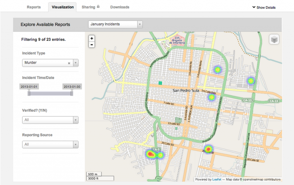
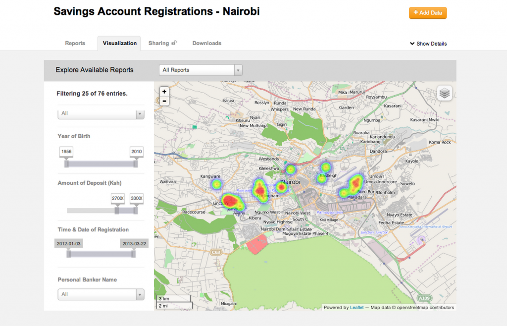
This BETA of CaerusGEO is our first answer to this need. A user is able to create her own survey, find a place in the world where it will be centered, create an atlas and data collection sheets through a standard schema they created, and then manage, visualize, and share the data once uploaded. By bridging cloud analytics to paper workflows, we are able to drive value at enterprise level.

If you’re an NGO and want to integrate mapping into your polling, you can create a survey, manage the data, and facilitate sharing from start to finish. If you’re a business looking to understand your market, you can integrate it into your customer registration process and benefit from basic market intelligence. Although basic in form, the value is derived from a more reality-based understanding of workflows in these markets. Paper matters.

Smarter Public Safety

The very first place we thought to experiment was in the domain of public safety. What could be more obvious than the need for taking those antiquated paper and pushpin constructions used for crude crime mapping and making it more dynamic, analytical, and transparent?

As the Deputy Minister of Justice in Monrovia told me, ‘we send the police where the people are, not where the crimes are… this could help us see how to use our resources in a smart way.’ We can address this challenge by finding minimally intrusive places to insert paper maps into the pre-existing workflows of policing institutions and fusing them together for digital analytics by a single node with connectivity to the cloud.

In parallel, NGOs and violence observatories have the capacity to collect and share their own data, creating a basic framework opportunity for enhancing social accountability within the security sector domain. Perhaps most interestingly, by integrating paper-based mapping that connects to real geospatial data, the longstanding art of Participatory GIS in conflict management and of Crime Prevention Through Environmental Design can be used in so many more ways.

Driving Value For The Private Sector

Public safety institutions are not the only ones we have learned can find value here. It’s also a pull for private sector development, particularly in the bottom of the pyramid. Microfinance institutions and others engaged in understanding their customer base face similar challenges.

By extending geospatial data capabilities to private sector development institutions and retail organizations, we have the prospect of significantly improving the precision and reach of private sector particularly to underserved areas.

So Much To Learn

Bending ICTs to the real-world challenges and workflows found in the last mile holds tremendous value to public and private sector institutions alike. For us, this experiment with geospatial information is only the beginning. We hope you’ll join us and give us feedback as our experiment moves on.

Matt McNabb is a member of the Board of Advisors for TechChange, and a Principal with Caerus Associates. For more, you can follow Matt and CaerusGEO on Twitter:  @mattrmcnabb  @caerusgeo