If you’re interested in learning more about how technology can support peacebuilding and conflict management programming, check out TC109: Technology for Conflict Management and Peacebuilding, being taught by TechChange’s Director of Conflict Management and Peacebuilding Programs, Charles Martin-Shields!

photowide

Social technology has captured the interest of emergency responders, peacebuilders, and policy makers due to the positive role it has played in disaster response in Haiti, peace promotion in Kenya, social revolution across the Middle East.  In ways that differ from disaster response, though, the politics and narratives of violent conflict demand a more nuanced, risk-averse approach to bringing high-volume communication technologies to the peace making space, especially in kinetic environments.

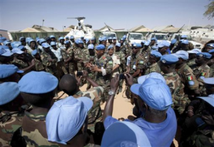
Emergent technologies such as mobile phones, social media and open-source mapping have had dramatic positive effects on emergency response since Ushahidi was first launched as part of the response to the Haiti earthquake in 2010.  While the emergency response community has embraced these technologies (more or less), the peacebuilding and conflict management communities have been more circumspect.  While there are good reasons for this, at some point a healthy skepticism of these technologies must give way to well thought out integration.  So how do peacemakers in both large organizations and small NGOs do this, given all the political and socio-economic pitfalls waiting in the conflict and post-conflict space?  What’s a lower risk way that small NGOs and individuals can be instrumental in gathering information that can be useful to large organizations like the UN Department of Peacekeeping Operations?

To answer this question we can look to the way that narratives and information evolve in multidimensional peacebuilding contexts.  The days of peacekeepers demarcating an agreed upon line between two parties are over – peace is being built in the middle of ongoing warfare, which means providing humanitarian aid, supporting economic development, and building political structures the can (ostensibly) represent citizens.  The information we need to do this can’t just come from satellites, closed-source intelligence and surveillance systems.  Virginia Page Fortna notes the importance of what the ‘peacekept’ need and want, and we have to reach out to them using channels they have access to.  Even in the hardest conflict zone, people have mobile phones to send SMS messages, they tweet, and they build live digital maps to track events.  This isn’t a replacement for classic closed source technology, it’s a supplement to make sure peacekeepers know what is on their host community’s mind, what people need, and their sentiments about the social and political space.

What communication technology and social media does is provide more individuals with the ability to tell a story.  These stories may be the same as the official account, or may deviate jarringly and in ways that make understanding the motivations of those involved in the fighting (or civilians trying to survive) harder to decipher.  In this space we see a key different between social media and communication technology in a disaster versus a conflict zone, and making the most of the technology requires recognizing this difference: in a disaster we use technology to respond to the situation, in a conflict we have to use it to understand the situation.  While the volume of stories can seem overwhelming if we can learn to listen more efficiently to the information from those we wish to help their stories can start to inform and increase the effectiveness of our peacebuilding efforts.


This post was originally published on the NDITech DemocracyWorks blog by Lindsay Beck (view original post), a student in TechChange’s recent course at George Washington University. For more information, please consider following @BeckLindsay and @NDITech.

As technology closes the time between when events happen and when they are shared with the world, understanding what approaches and tools are the best solutions to implement in crisis response and good governance programs is increasingly important. During the “Technology for Crisis Response and Good Governance” course, which I took earlier this month offered by TechChange at GW, our class was able to simulate different scenarios of how such tools can be used effectively.

The first simulation we did was on how to use FrontlineSMS and Crowdmap to track and respond to incidents in the event of a zombie apocalypse. Each team was responsible for managing FrontlineSMS, mapping incidents and other information on Crowdmap, and going into the field to get more information and verify reports. Management of the incoming data at this point becomes the highest priority. Designating specific responsibilities to different individuals, and determining how to categorize data (reports to be mapped, questions to be answered by other officials, overly panicked individuals, etc.) helps to more efficiently handle processing a large amount of information during a short timeframe.

The next simulation was on how to use a variety of open source tools and resources to enact an election monitoring mission. While the temptation was there to think about what the tools could do to meet specific aspects of the electoral process, instead it was quite clear that workflow and anticipated challenges needed to be identified first before using these technologies. For example, in a country where internet and mobile phone coverage does not reach the entire population, making sure that outreach is also accomplished through “low-tech” mediums like radio broadcasts as well as distribution of leaflets or other informational materials through local community organizers will reach a wider percentage of citizens. In countries like Liberia, use of “chalkboard blogs” that share community-relevant information could even be leveraged. Tech alone, even more ubiquitous mobile tech, is not sufficient to reach all potential voters.

Using tools during significant political and social moments is useful in attracting the attention of and inform the local and international community.  However, local context has to be taken into consideration, particurlarly in countries that discourage citizen engagement and transparency of political processes like elections, can emerge.

Could sending an SMS about violations being committed against members of a community put a sender at risk? In most countries now, a mobile phone user must provide some degree of personally identifiable information (PII) in order to purchase a SIM card, ranging from a name, home address to a photocopy of a passport or national ID card and even increasingly biometric information. Match this with the increasing efforts by governments to curtail use of mobile communications (particularly use of bulk SMS), along with pre-existing insecurities of the mobile network, and it becomes nearly impossible to exchange information securely over SMS, or send them to be reported on a platform like Crowdmap. While encrypted SMS tools like TextSecure exist, they are not available on feature phones or “dumb” phones that are the most widely used internationally nor are they easily deployed for crowdmapping efforts.

When making use of crowdsourcing and mapping applications to track incidents, such as during an election, a large amount of data is collected and can be shared with a wider community. But what happens to that data? Simply putting a map on a governance- or crisis response-focused project does not ensure continuity and sustainability of a project. Instead, defining an approach to make greater use of collected information can help strengthen follow-on activities beyond the event date. Establishing a bigger picture strategy, and then incorporating ICT elements as they fit makes for more effective projects, rather than creating “technology-first” projects that consider political and social considerations after the tools.

Best practices conferences are critical to the growth of any community. The sharing of ideas and capturing of collective lessons-learned allows for those both in attendance, and those reading any after-action report, to proceed with their respective related projects having gained new insight, or having made new partnerships with other like-minded individuals and organizations. However, just as websites are now building responsive design as “mobile first” and desktop second, it’s time to start thinking about these events differently. No longer should we think only about planning offline events that “we webcast,” but rather about global conversations facilitated by online engagement that have an in-person conversation or presentation at its core.

Patrick Meier, co-founder of CrisisMappers, Digital Humanitarians & Standby Task Force speaking at the ICCM

In no community of practice is this more true than with Volunteer Technical Communities (VTC’s) like crisis mapping, which depend on the goodwill, real-time information, and online cohesiveness that can be properly augmented by online engagement. And keeping in line with both the principles of crowdfeeding and the fostering of global online learning communities, this past week’s International Conference of Crisis Mappers exemplified the benefits of online integration, as mappers and technologist from around the globe gathered both online and in Washington, DC for four days of conversation. By providing the global VTC with the ability to engage via a live webcast and an interactive chat forum, the information shared in the halls of the World Bank shifted from being mostly for the benefit of conference attendees, to truly engaging with the global community of crisis mappers.

By livestreaming the event, the ICCM’s webcast enabled the inclusion of over 950 additional attendees – almost doubling their audience!


Looking ahead, it isn’t just the Crisismappers team that would be best served to continue focusing on this level of digital engagement. In many ways they are thought leaders in this field through their engagement with online learning communities. However, other international organizations that focus on issues such as open governance and transparency often fail to lead by example on these issues, holding conferences that are limited to small audiences, and comprised only of individuals who can afford the time and airfare necessary to be in attendance. As distance learning practitioners, we feel strongly that effectively used learning tools can act as a driving force for social change. And in the case of live events – by bringing more voices to the table in low-cost way, simple information sharing mechanisms such as this can enable otherwise disparate communities and engaged individuals to be both teachers and students, sharing in the collective learning experience.

Linton Wells from National Defense University speaking at the ICCM

Today, the barriers to entry with this kind of online engagement are so low, that all takes is a bit of planning and a small amount of technical know-how to get up and running. I would even wager that the cost of breakfast at your event is significantly more than that of ensuring web connectivity and online involvement. And while communities of practice used to be local because business and organizations were local; today, globally minded organizations must ensure global engagement, as technology has reached a point at which there’s almost no excuse for allowing only those within a close geographic proximity access to your event. As we said – leave the bagels, keep the connectivity.*


*TechChange would still be delighted to eat breakfast at your local Washington, DC event, including bagels if that’s what is on the menu.

The past weekend was busy for the crisis mapping community, with a very full four days of events at the International Conference on Crisis Mapping.  While the ignite talks and self-organized sessions were fantastic what capped off the weekend for about 30 of us was the day-long activation simulation of the Digital Humanitarian Network (DHNetwork).  This effort was made possible by the support of the ICT4Peace Foundation who provided funding for logistics and for TechChange to design and carry out the simulation. UN-OCHA provided travel support to DHNetwork members who needed assistance in order to ensure that all entities could participate.  As well, key observers such as UN-SPIDER, USAID, the State Department, Department of Defense, Harvard Humanitarian Initiative (HHI), and the Woodrow Wilson Center were invited to be present and give direct feedback throughout the day.

(more…)

Go to the live webcast (starts Friday, Oct. 12 at 2:00pm)

Good news, everyone! TechChange has been asked to livestream the second day of the 2012 International Conference of Crisis Mappers on Friday, October 12! If you’re not already following the livetweets on hashtag #ICCM and from @CrisisMappers, please do tune in!


ICCM Livestream Schedule for Oct. 12, 2012

Note: This is a shorter schedule than the one listed on the full agenda.

  • 2:00pm-2:10pm Welcome remarks by Dr. Jen Ziemke, co-founder of CrisisMappers
  • 2:10pm-2:20pm Intro remarks by Dr. Patrick Meier, co-founder of CrisisMappers
  • 2:20pm-3:30pm Ignite Session 1: Talks 1-16 [Preston Auditorium]
  • 4:00pm-5:15pm Remarks: Neils Holms-Nielsen [World Bank], Christiaan Adams [Google], Dan Palmer [JCU], Tara Cordyack [GeoEye], Camille Cassidy [DigitalGlobe] Special Remarks: Salem Avan, Chief, Knowledge Management Service / United Nations, Office of Information & Communications Technology Keynote Address: Robert Kirkpatrick, Director of UN Global Pulse
  • 6:00pm-7:00pm Ignite Session 2: Talks 17-31 [Preston Auditorium]

If you’re interested in mapping in crisis zones, consider taking our course Tech Tools and Skills for Emergency Management that runs from September 3rd – September 28th. 

Cross-posted from Greg Maly’s blog, Multitracked. He is currently working on a mapping based research project run by the University of Denver in New Delhi, India.

This past May we published a blog piece outlining some of the basic lessons learned from TechWeek at Korbel. One of the main takeaways was that technology solutions, though a potentially powerful set of tools, are only 10% tech and 90% people power.

This includes not only putting people in the drivers seat for the use of these tools over time, but also at the onset of any project when considering the need, or gap, they are intended to fill. A few months later, these lessons have become ever more salient as my team from the University of Denver works on the design of a maternal and child health monitoring system for the community of Jasola – a high risk population that borders the Yamuna river in New Delhi, India, and consequently suffers from high child and maternal mortality rates.

Keeping the importance of local ownership in mind from the onset of our project, and working with our local counterparts in the region – a Gender Resource Center (GRC) staffed by women who both live and work in the community – we began by holding a series of focus group discussions with the primary stakeholders in the region: young mothers and pregnant women, doctors who run small health clinics, and community health workers. In each meeting a number of grievances arose, from a lack of resources and shortage of doctors relative to the size of the population in the region, to the difficulties of maintaining effective communication between doctors and patients. As an example of the effectiveness community driven conversations, through these focus group sessions we learned that knowing the location of pregnant mothers was one of the greatest obstacles to routine checkups. This we could work with relatively quickly.

A simple fix was the breakdown of the community into the separate Mohallas, or neighborhoods, which are already well known to community members, but haven’t made it into any form of visual representation. A few afternoons of community mapping using handheld Garmin GPS units and an OSM update quickly fixed the problem and moved the conversation forward a few steps, allowing new ideas to unfold – many of which came from the GRC staff themselves.

Like many health projects around the world, this one has a long way to go. The problems are greater than any solution of this scale can begin to truly address. However, small wins like these slowly begin to even the playing field as communities become empowered to address problems one a time, and with sustainable solutions that do not require a large number of additional resources. In this case, we’re happy to report that community members are on board, including some young mothers who have joined the conversation. Updated maps are being connected with a system that will aim to track mothers from conception through to birth. And though our DU team is set to return home in just two weeks time, I can already tell that the community members see the benefit of this project, and are ready to push it forward with or without us for the long haul. Who knows – there might even be a tablet involved. Stay tuned.


If you are interested in using technology for peacebuilding consider taking our course, Technology for Conflict Management and Prevention, starting July 23rd. 


Social media plays a major role in raising awareness about mass atrocities. In the most visible example, Invisible Children’s Kony 2012 video has garnered more than 90 million YouTube views. But the utility of social media for preventing atrocities goes beyond advocacy—a utility that the U.S. government (USG) should explore and embrace. How can the USG best leverage these tools for its atrocity prevention efforts?

For one, the White House should commission a study that assesses the value of creating a Mass Atrocities Prevention Center (MAPC) to collect, analyze, and distribute intelligence on atrocities from all relevant sources including social media platforms.

There are, of course, dangers in establishing new bureaucratic structures. In many cases, they muddle lines of communications and authority. But, certain new structures have significantly enhanced the USG’s response to complex threats. One such example is the National Counterterrorism Center (NCTC), which could serve as a model for the MAPC.

The NCTC was created as a fusion center for intelligence from a range of disparate sources on terrorist activities.

As with terrorism, there is a wide range of potentially useful sources for garnering intelligence on atrocities. Social media platforms that are household names—YouTube, Twitter, and Facebook—can be used for documenting and warning about atrocities. Less well-known but equally useful initiatives such as Ushahidi and Small World News can serve a similar purpose.

Organizations are already using these tools to bring atrocities into the public eye. Amnesty International’s Eyes on Syria and Resolve’s LRA Crisis Tracker are two notable examples in this regard.

The USG should now look at ways to leverage the information from these and other “open” (i.e. unclassified) sources in its atrocity prevention efforts.

The MAPC would thus build a strong working relationship with the intelligence community’s Open Source Center given that, based on the center’s stated mission, it’s theoretically best positioned to collect intelligence from social media platforms.  As an independent center, the MAPC would then be able to synthesize open source with classified intelligence on atrocity threats.

A challenge brought by social media and other technological developments is the tsunami of information now available on any given event. In fact, humans today create as much information every fifteen minutes as collected by the Library of Congress in over two centuries. And endemic in the information overflow is falsehoods and untruths.

The 2008 Albright-Cohen task force on genocide prevention readily recognized these challenges:

“The bounty of information—which can only be expected to grow in the future—does not necessarily ease the analytic challenge. First, the amount of material can be overwhelming, and second, it is hard to judge the accuracy of the reporting. For example, a crucial and difficult task for analysts is to distinguish systematic killing of civilians from more general­ized background violence, as most if not all mass atrocities occur in the context of a larger conflict or a campaign of state repression.  The accuracy of analysts’ warnings will also depend on the extent to which they can identify warning signs or indicators of genocide and mass atrocities.”

The MAPC should have a directorate—based on the NCTC’s Directorate of Strategic Operational Planning (DSOP)—that develops an analytic framework for managing the high volume and veracity of intelligence flows. The MAPC’s version of the DSOP would inter alia identify the most relevant sources, develop a framework for analyzing social media, and create a comprehensive mass atrocity prevention intelligence strategy that synthesizes open and classified sources.

In sum, social media could be an important tool for improving the USG’s intelligence on mass atrocities. But the intelligence community and policymakers won’t be able to leverage these sources unless the USG has the bureaucratic structure in place do so. As of now, this structure doesn’t exist. The White House should consider standing up a MAPC to change the status quo.


Andrew Miller recently participated in TC104: Global Innovations in Digital Organizing. He works on conflict prevention at a Washington, DC think-tank and can be found on Twitter at @andrewmiller802.

For those interested in Technology for Peacekeeping consider taking our online certificate course, Technology for Conflict Management and Prevention, starting July 23rd.

**Disclaimer: These are Asch’s personal views and do not represent those of his employer.

You’ve heard of the 90/10 rule, right? I hadn’t heard the concept, at least, until recently. The meaning, though, I learned the hard way—an ICT-enabled project should be 90 percent planning and only 10 percent digital tool.  Not the other way around.

We initiated the Nigeria Security Tracker, an effort to catalog and map political violence based on a weekly survey of domestic and international press, at least two years ago. We wanted to answer the question “are things getting worse in Nigeria?”

The death of Nigeria’s president in office with upcoming elections, an increasingly divided electorate, and an apparent up tick in violence in the north and the middle of the country raised serious doubts about Nigeria’s stability.

And yet many disagreed. The optimists said things were getting better; the pessimists that Nigeria was becoming a “failed state”; and everyone else that Nigeria would continue to “muddle through,” as it had done since independence in the 1960’s.

Measuring levels of violence seemed like it could give us a more precise answer. While the Nigerian press has many shortcomings—lack of journalist training and professionalization, concentration of ownership and coverage in the south—it is relatively free, and there is a lot of it. Also, the presence of major outlets like Reuters, BBC, AP, AFP, and the Wall Street Journal added another layer of reliability. Indeed, some of the best Nigeria analysis I’ve seen comes from open sources. You just need to learn to read between the lines.

Mapping seemed like a useful and visually engaging way to organize our information. But without funding or any programming experience, our options were limited. We experimented with manually pinning incidents to Google maps and embedding on our blog. We tried to pitch Ushahidi to the web department hoping to get programming support, but without success.

Eventually, we abandoned the project–until Crowdmap was launched. Free, hosted on Ushahidi servers, preprogrammed, and simple to set up and use, it made the security tracker possible.

Our Mistake

We designed our research methodology around Crowdmap capabilities. We could include basic descriptions of events, and simple codings as well as details like causalities, but it was labor intensive.

Not until three months later, when we sat down to review our work, did we realize the shortcomings. Putting incidents on a map is useful if you want to see where violence is happening. But less so when you want to know when incidents occurred, or if you wanted to look at trends or correlations over time. (The automation feature of the map, while fun to watch, is not a terribly useful analytical tool.) We discovered it was impossible to look at, for example, the relationship of violence perpetuated by the security services and causalities.

Fundamentally, the project was supposed to be about the information captured. Not the technology. And we had it backwards.

We also discovered a major lost opportunity. Because we tailored our methodology to what could be included on the Crowdmap, we failed to capture other useful information, such as attacks on religious establishments, which only required marginal extra effort.

The Redesign

Given that our project was supposed to answer a particular question that a map alone couldn’t, we relegated the Crowdmap to a component of the project–no longer the driver. We thought more thoroughly about what kind of information we needed, and what we could glean from press reports of political violence.

Fortunately, we had documented all of our sources. So we could return to our original information and recode, albeit with a significant time commitment.

The Way Forward

Despite better planning the second time around, we continue to find shortcomings. We defined one variable, “sectarian violence,” inadequately, which means coding has been inconsistent throughout the project, making it less useful.

We are also vulnerable to technical problems on Crowdmap’s end. When there is a bug in the system, there is nothing we can do but wait for Ushahidi to fix it. (Recently, the site was down for about a week.)

Finally, we now have a year’s worth of information. It’s a huge dataset. And we still haven’t figured out what to do with it. Yes, we can make defensible, conservative estimates of causalities caused by actors like the police or Boko Haram. We can also show any escalation or decline in violence across the country.

But this only scrapes the surface of what our data can tell us. Admittedly, this is a good problem to have.  But given the time and resources we have already committed, and the wealth of date we have accumulated, we are constantly trying to balance benefits of the security tracker with the costs of maintaining it.

Asch Harwood is a specialist on Africa at a New York City-based think tank.