By Omondi Peter, GDDF Ambassador – Kenya

Being a sports enthusiast, Covid – 19 meant no team sports, and this was frustrating to me. I spent much of my time indoors building and testing online Life Skills Challenges for my students which I found interesting and consoling in some way.

During the Covid-19 pandemic, TechChange was looking for volunteers to help facilitate Happy Hour Sessions during the Our Future Our Voices Youth Summit under International Youth Foundation.

I signed up for the role and I was accepted. This role gave me an opportunity to learn and connect with a wide range of professionals from across the globe. My favorite moment though was the points segment whereby contributing and engaging on discussion threads earned one points. I emerged the top point winner for the Summit, and I felt so nice about it.

Since then, I kept following TechChange events and in 2022 I saw an open call for participation for Global Digital Development Forum to which I signed up.

My main aim here was to be the most active platform user and contributor on discussions that I felt were relevant. My goal was to earn the most points and win. I attended nearly all the live sessions, breakout sessions, listened to all the lightening talks, attended most the tech demos, and had my nose in nearly every virtual room of the GDDF 2022. Turned out to be the top point winner with 1852 points, followed very closely by Wayan Vota who came in second with 1631 points. Again, I felt motivated as I had found my niche and field of play.

Being a Top Point winner, I had a number of offers to choose from, I selected a 30 minutes 1 – 1 coaching session with CEO TechChange Nick Martin, our meeting was facilitated by Kristen Weymouth and I met Nick Martin who hinted to me about the Hybrid Pilot projects regarding the GDDF and asked if I would be interested to be part of that, I said to Nick, “By all means, bring it on.” True to his word I was recruited as an Ambassador for the Frontiers of Digital Development Forum in 2022, where my role was to organize and facilitate a hybrid watch Party in Nairobi.

Come 2023, TechChange again was looking to roll out a hybrid pilot for the Global Digital Development Forum and I was asked if I would be interested to be an Ambassador for the GDDF 2023 to which I accepted. This time I had two goals, to lead one of the best Watch Parties and to be the top point winner on the GDDF TechChange Platform.

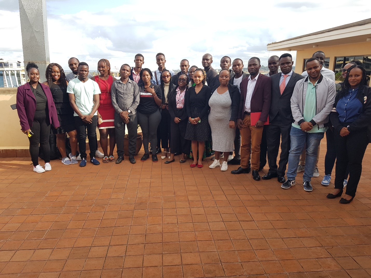
GDDF 2023 Watch Party at Palladium’s Nairobi offices

I can proudly say I did both and felt really good about it. By being part of the first ever hybrid version of GDDF, leading a watch party that brought 29 participants and seven major organizational representatives in one room to engage on real issues affecting their local communities, the following are some of the lessons I learnt going through the process.

  1. TechChange has a working model that is already transforming the convening landscape starting with Tech players and industries and more partners and stakeholders need to join in.
  2. We do not have to travel to New York City etc for conferences to engage on issues affecting us locally, we can just be empowered to organize our local sessions and synchronize that to the main event happening anywhere around the world.
  3. Building partnership is key for such projects to thrive, thank you to Palladium; Make it possible for believing on the idea and sponsoring and hosting the Kenya Watch Party.
  4. Young people are a powerhouse of change, all they need is a clear direction and tools to realize their full potential.
  5. The pandemic has transformed the way people view things especially the education and convening models and the hybrid mode approach is the way to go.

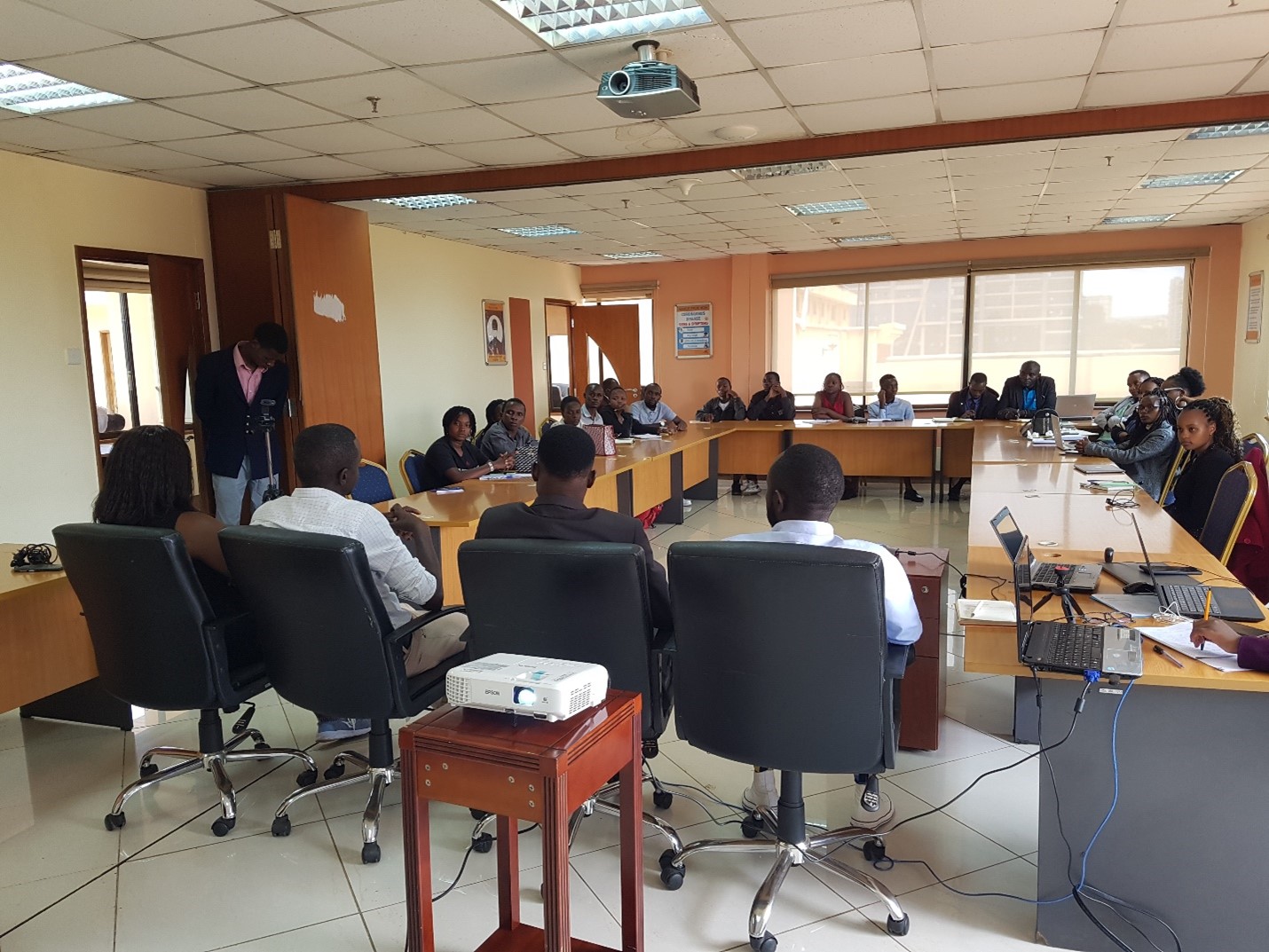
The Kenya watch Party event was unique, as it involved both local and international guests, with the most enticing element being the Team Project at the end where participants were divided into 4 groups, each group was tasked to come up with a project they will undertake post the GDDF 2023 to help mitigate Climate Change issues in Kenya.

With TechChange providing an open space for the ambassadors to create their own models to meet their own needs made the whole concept more interesting and fun as it allowed flexibility and creativity resulting to diverse outcomes.

With the firm foundation established for the future GDDF, the team is now building their own momentum focusing on the 2023 Kenya Watch Party Theme “Tech4ClimateChange” both online and offline looking forward to the GDDF 2024.

By: Emma Sakson

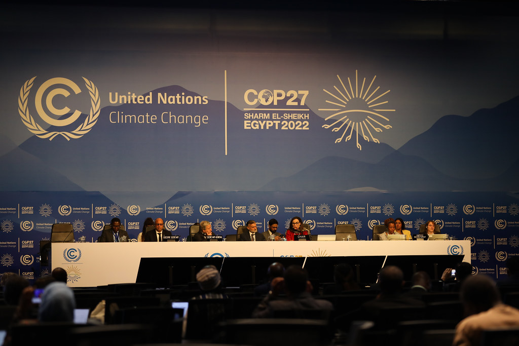
Delegates from all over the world have returned home after attending the 27th Conference of the Parties of the UNFCCC, or COP27, which was convened in Sharm El Sheikh, Egypt over the last few weeks. The first African COP since 2016 brought government representatives, climate activists and advocates, lobbyists, and policymakers together to hash out the details of an ambitious agenda to translate climate commitments and pledges into collective action towards our shared future. 

COP27 panel (from COP27 media library)

Conveners came into a challenging, tense situation in Egypt, as the legacy of broken promises from COPs past loomed large, and many wondered whether any real progress could be made on topics that always seem to be a high-priority in name but not action. 

At TechChange, we believe in the power of bringing people together to tackle big challenges related to topics that matter. And as someone who is obsessed with convenings, I was curious to see if COP27 would be the opportunity to do just that: tackle big challenges related to one of the topics that matters the most to every one of us on this planet. 

While TechChange did not attend COP27 (we were busy hosting our inaugural Frontiers of Digital Development Forum!), we recognize the critical nature of this event and the work that countries, institutions and our partners do to harmonize global efforts to mitigate and adapt to the consequences of climate change. 

In the days ahead, we’ll be keeping an eye on the following topics and key agenda items from COP27 to see if this convening can move the proverbial needle:

1. Climate finance must be prioritized

Low- and middle-income countries need more than $2 trillion in annual investments by 2030 to help fight climate change, yet commitments from climate funds are far from enough to fill that shortfall.  The low- and middle-income countries most vulnerable to climate change have been vocal about the need for an agreement on loss and damage, or climate reparations, which has always been a somewhat controversial topic in the COPs of years past. In the final hours of COP27, the establishment of a loss and damage fund was agreed upon so that the high-income countries that helped to create the current climate crisis will compensate the countries experiencing the consequences of their actions. While the details of who will contribute and who will receive what from the fund remain unclear, it’s a huge step in the right direction. There are also strong calls to mobilize private capital and reform multilateral development banks to help fill this huge funding gap, but only time will tell if the status quo will actually change.

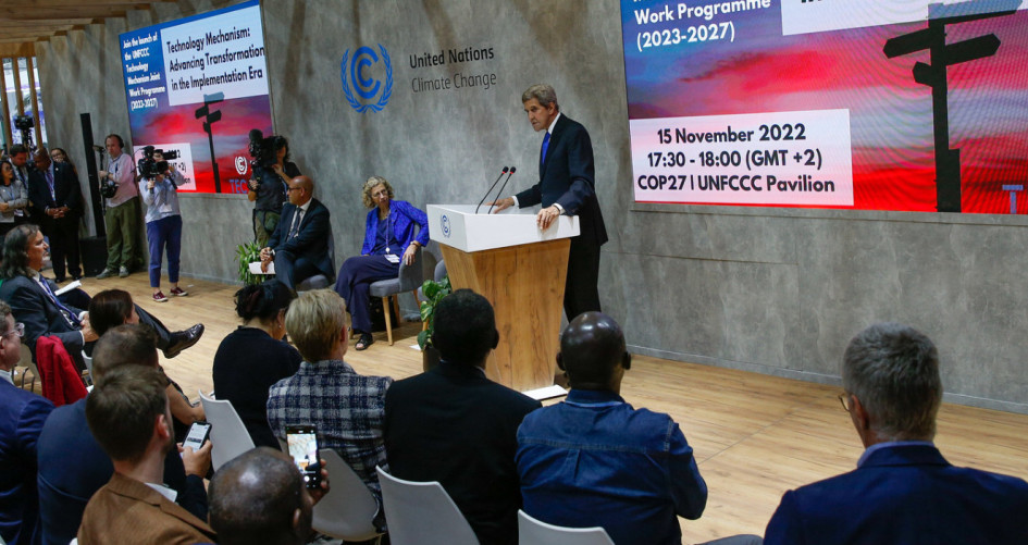
John Kerry addressing the COP27 delegates (from COP27 media library)

2. Trust must be rebuilt

Commitments and promises made by high-income countries to lower-income countries have been broken time and again in the past. Countries in the global south are feeling the disastrous impacts of climate change much more acutely than those in the global north, and suffering the consequences of other countries’ action (and inaction). Countries and institutions must prove they are good on their word and take action on their commitments coming out of COP27, or the galvanizing words spoken on stages are nothing but platitudes.

3. Our systems are failing, and quickly

As countries struggle with their own unique problems and pressures, the systems we have built, at a micro and macro level, are failing. Conflict, such as the war on Ukraine, have destabilized energy and food systems, and the COVID-19 pandemic continues to wage war on health systems globally. Natural disasters, such as the horrific floods in Pakistan and the drought in Horn of Africa, have taken countless lives and wreaked havoc on communities. The humanitarian system cannot support the needs of refugees, IDPs and human migration at large. We need to move quickly and strategically to address the most pressing challenges facing each of these systems, all of which are all feeling the heavy effects of the climate crisis.

***

These are only a few of the critical and multifaceted challenges discussed at COP27, but also some of the most pressing. As more convenings related to the climate crisis are organized in the weeks and months ahead, we’ll see if real progress on these issues is made and if the power of convening at COP27 can bring us closer to the future we are working towards. 

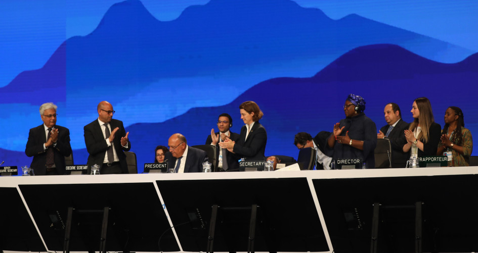
“Loss and damage” fund signing at COP27 (from COP27 media library)
Bob Corbett’s final mapping project on flood-prone areas in Bangladesh. (Note: this map was prepared as a mapping exercise. Anyone viewing the map should understand that it would need to be reviewed and validated by a qualified expert before it should be relied upon.)

By Bob Corbett, TC141: Mapping for International Development alumnus

During my undergraduate work in Landscape Architecture, I learned a method of analyzing spatial data by overlaying various types of information on acetate sheets or tracing paper developed by Ian McHarg, a Scottish landscape architect. The technique is described here (Note: I am not related to the author). I have always been fascinated by this technique and the GIS capabilities available today make this type of analysis readily possible. This offline overlay technique was the basis of my final mapping project in TC141.

In mid-2011, I launched SMS in Action, an Ushahidi Crowdmap that lists text message based programs worldwide that contribute to the social good. To date, nearly 240 programs classified under 29 different categories have been profiled on SMS in Action and viewed by thousands of visitors from 119 countries. With my general interest in mapping piqued by my Crowdmap experience, I ventured into crisis mapping with the Standby Task Force and more recently, Crisismapper deployments using the Tomnod platform. I have since worked on a variety of crisis mapping efforts from locating refugee encampments in Somalia, to tracking forest and bush fires in Colorado and Australia and identifying storm damage after Typhoon Haiyan/Yolanda in the Philippines to name a few.

TC141: Mapping for International Development

Taking the online course, Mapping for International Development, allowed me to combine my interests in ICT4D, international development, data visualization, and a love of maps. I very much enjoyed the format of TC141 with the combination of live presentations, weekly readings and videos, exercises, discussion forums, and the step-by-step instructions and “how-to” materials. Although I tried to “attend” each live presentation the fact that everything was archived for viewing at my convenience was a real plus. This being my first online course, I was surprised at the level of personal interaction available between participants as well as with the facilitator. Chris Neu was a great facilitator: always enthusiastic, arranged interesting presenters and shared an immense amount of information with course participants. I had no specific goals for the course at the outset other than to broaden my knowledge of available mapping technologies. I quickly realized TC141 provided me a chance to gain a capability to work with GIS, a long-term interest of mine. As a result, I selected QGIS, the open source GIS platform as the primary platform upon which to develop my course project.

Mapping with QGIS and MapBox’s TileMill
In a preliminary course exercise we were introduced to MapBox/TileMill. In a follow-up exercise I used MapBox/TileMill to create a simple map of the top ten world coastal cities at risk from flooding due to climate change – including Dhaka, Bangladesh. Given that we have a family friend from Bangladesh, I felt a more detailed investigation of flooding patterns in Bangladesh, an increasingly frequent problem, might lend itself to my major project for the course.

Drawing upon existing sources of information available via the Internet, I located shapefiles for administrative districts, the extent previous flooding, road systems, airport and hospital locations, topographic information, population data and more. After importing this information into QGIS I was able to identify recently flooded and flood prone areas of the country. Seeing how flooding can compartmentalize the country and disrupt the movement of people and relief supplies between areas, I then performed a quick search of key medical facilities and major airports to better understand which would be affected and which might be available to support relief efforts. The QGIS-based flood map was then exported into MapBox/TileMill where it was further refined using the tools and capabilities within the MapBox platform.

Mapping Bangladesh’s Flood-Prone Zones
Given that our Bangladeshi friend is engaged in development activities in the Khulna administrative district, I wanted to see whether flooding in Khulna might impact their area. Based on Internet research, I chose flooding from a 6-meter storm surge as the basis to work from. I then located ground elevation data for Bangladesh and loaded the file into QGIS. By filtering the elevation data I was able to “see” the general extent of flooding that might be expected in Khulna District by a 6-meter storm surge. I was very pleased with the resulting maps and the new skills and capabilities that I had gained. Prior to taking TC141, I was not even aware of QGIS or MapBox/TileMill. I feel compelled to note that my “flood maps” were solely academic mapping exercises and should not be interpreted to be definitive maps of anticipated flooding in Bangladesh. However, it did show me the new capabilities I had developed as a result of TC141.

Mapping in My Future
TC141 offered much more information than I have touched upon here. One area of discussion in the course was OpenStreetMap and Humanitarian OpenStreetMap. With my past involvement with crisis mapping I have developed an interest in pre-disaster planning. Although post-disaster efforts often involve hasty mapping after an event I am interested in what types of information and infrastructure could and should be mapped in advance of disasters as part of a preparedness program. For example, if we believe that climate change is expected to result in an increased frequency and intensity of tropical storms, typhoons, hurricanes, cyclones, etc. shouldn’t first responders and aid agencies have reliable maps to work with prior to a disaster? The Philippines experience, on average, 20 tropical storms per year. Accurate up-to-date maps of facilities and infrastructure needed to recover from such emergencies post-disaster should be mapped in advance in OpenStreetMap as part of a preparedness program. I am interested in learning more about the types of facilities and infrastructure that need to be mapped in advance as part of a preparedness effort and see OpenStreetMap as a logical platform for presenting that information.

Interested in learning how to build your own digital maps using the tools that Bob learned? Enroll now in our 4-week digital mapping course, Mapping for International Development.