Why We’re Creating a Digital Mapping Course for International Development Professionals
|
Remember when map making used to be simple? Neither do we, which is why we’re teaching a new course on Mapping for International Development. This increasingly complex intersection between open/closed data, online/offline tools, and practitioner communities all relevant to digital mapping could use a handy primer.
Last week, MapBox closed a $10 million Series A from Foundry Group as part of a move seen to rival Google Maps with an open-source mapping solution. While the results of this investment remain to be seen, there are echoes in this conversation from the intense debate last year around the World Bank’s initial decision to use Google Map Maker instead of OpenStreetMap, which raised concerns from organizations such as Global Integrity about why the bank would choose a closed data solution over an open one. Ultimately, the World Bank reversed its decision and went with OpenStreetMap, which provides simple, complete access to its database under an open license.
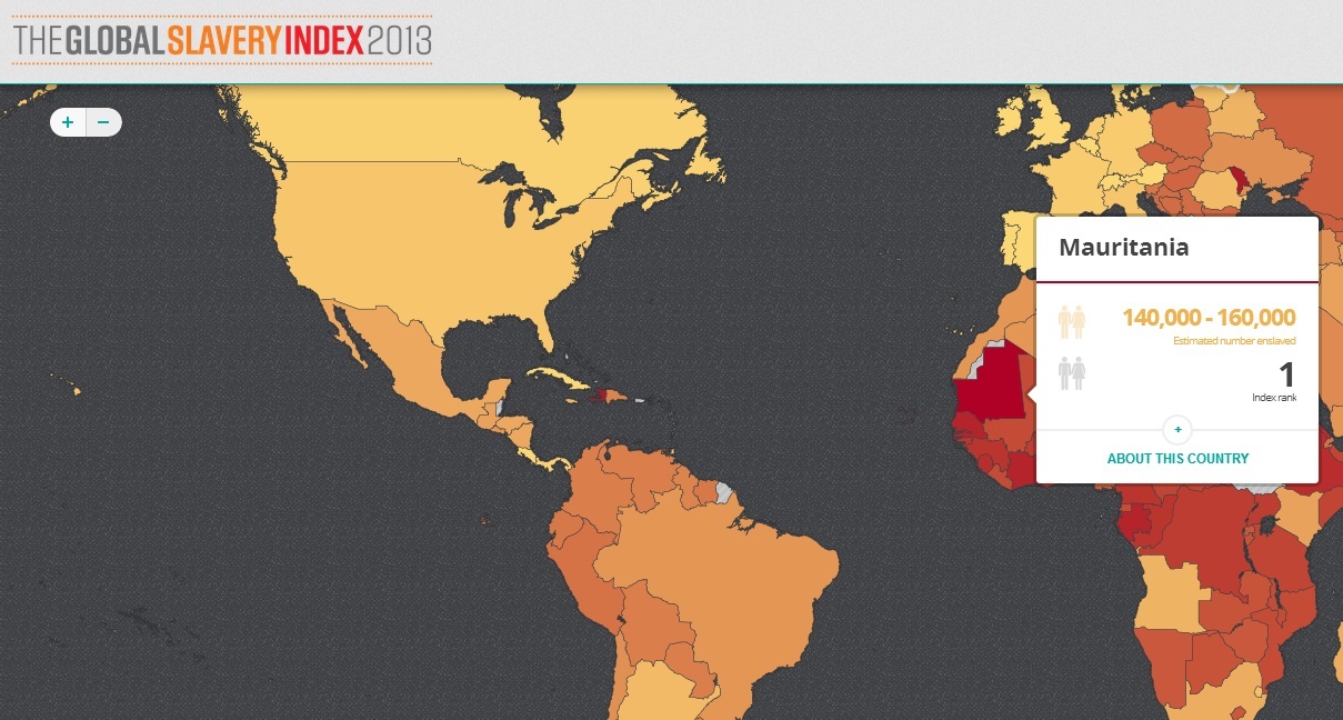
And it’s not just about the maps themselves, but what is being done with them. The Global Slavery Index by Walk Free chose to visualize slavery numbers by country. Team Rubicon partnered with Palantir to repurpose maps used to track IEDs to help rebuild homes needing repair after Hurricane Sandy. Democracy International and New Rights Group visualized voter data in Tunisia to present stakeholders with better information for the electoral process. And InterAction produced an NGO Aid Map to improve coordination of NGO activities.
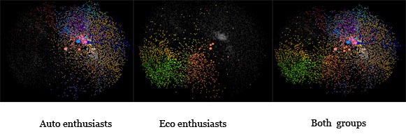
Photo Credit: The Atlantic
But data visualization and mapping isn’t just restricted to geodata. Since information and individuals are only a click away online, work being done by Morningside Analytics to map the “cyber-social geography” of the internet — analyzing who is talking to whom and what they’re talking about — is just as valuable, if not more so.
So far, we’ve had a great response for the course on Mapping for International Development, which is nice to know we’re not alone in our enthusiasm. We’re excited to welcome participants so far from about a dozen countries including Australia, Cameroon, Canada, Ecuador, Jordan, Kosovo, Mexico, the Netherlands, the Philippines, USA, and UK. Participants in this course represent organizations such as the World Bank, UN Foundation, UNICEF Innovations Lab Kosovo, Gallup, InterAction, Telecentre Foundation, Canada Foundation for Innovation, Australian National University, IFES, School of Oriental and African Studies, Centre for Development Innovation, Generations for Peace Institute, ACT/JEVS Human Services, CIMM, Stability: International Journal of Conflict and Development, and many more.
There’s still time to join, so if you’re interested in registering for our four-week online class on Mapping for International Development, register here. We hope you’ll join us!
As we were wrapping up a live course event with MAMA (the Mobile Alliance for Maternal Action) yesterday, we learned the...
Earlier this month I sat down with Dr. Craig Zelizer, Associate Director of the Conflict Resolution MA Program at Georgetown University...
One of the things that sets the TechChange platform apart from other online courses is the network you are immersed...